
Last Updated on November 6, 2025
Driving in Costa Rica: What's Covered
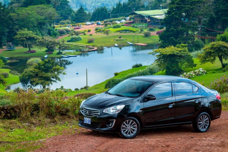
Costa Rica’s roads range from modern Highway 27 to the Pacific to challenging mountain passes where GPS underestimates time by 25-50%. Standard cars work for SJO to Manuel Antonio and Guanacaste beaches; 4WD is required for Monteverde, Santa Teresa, and Osa Peninsula. Green season afternoon rains turn gravel roads muddy—add 30-45 minutes to mountain routes.
Quick Facts:
- Dry season (December-April) offers optimal conditions; green season (May-November) requires extra caution and time
- Navigation uses landmarks (churches, soccer fields), not street addresses—download offline maps before departure
- Wildlife crossings are common at dawn/dusk—sloths, coatis, iguanas regularly cross roads, especially near “Sloth Crossing” signs
- Speed bumps (reductores) appear suddenly, often unmarked—can damage vehicles if hit at speed
- Rush hour traffic in San José (6:30-8:30 am, 4:306:30 pm) significantly delays travel
Top 5 Driving Challenges:
- Mountain Roads – Hairpin turns, steep grades, and blind curves require constant attention; use lower gears on descents to prevent brake overheating
- Unpaved Surfaces – Secondary roads to Arenal hot springs, beaches vary from decent gravel to 4WD-only terrain
- Weather Changes – Monteverde goes from clear to zero visibility in minutes; afternoon storms flood roads during the green season
- Missing Signage – Major highways are well-signed; secondary roads often lack markers—towns are signed one direction but not returning
- Regional Variations – Caribbean coast roads are narrower with less infrastructure; Tortuguero boat-access only
If you need help choosing the right vehicle and planning your driving route through Costa Rica, contact us now!
Planning to drive in Costa Rica? Smart choice for exploring this incredible country! But here’s what most rental companies won’t tell you – that “easy 2-hour drive” from San José to Manuel Antonio becomes a white-knuckle mountain adventure if you’re not prepared for the reality of Costa Rican roads.
The difference between a stressful vacation and an amazing adventure often comes down to understanding what you’re really getting into behind the wheel. Let’s dive into the real story of Costa Rican roads – beyond the rental counter warnings and into practical advice that’ll have you driving like a local.
What's the Deal with Costa Rican Roads?
Costa Rica’s road network tells the story of a country that developed organically around its mountainous geography. You’ll encounter everything from modern four-lane highways to single-lane mountain passes that haven’t changed much since the 1960s.
The main arteries connecting major tourist destinations are generally well-maintained. Highway 27 from San José to the Central Pacific coast represents Costa Rica’s road infrastructure at its best – smooth pavement, proper guardrails, and clear signage. Similarly, the Costanera Sur coastal highway offers relatively easy driving with spectacular ocean views.
But venture off these main routes? You’ll quickly understand why locals joke about “Costa Rican time.” That GPS estimate of 2 hours might easily become 3.5 hours when you’re navigating winding mountain roads with hairpin turns and breathtaking drop-offs.

Which Types of Roads Will You Actually Encounter?
Primary Roads (Rutas Nacionales)
These numbered routes connect major cities and tourist destinations. Generally paved and well-signed, though conditions vary significantly. Route 1 (Interamericana) runs north-south through the country, while Route 27 connects San José to the Pacific coast.
Secondary Roads
Often unpaved or partially paved, these connect smaller towns and lead to many popular destinations like Monteverde or remote beaches. Road quality ranges from decent gravel to challenging four-wheel-drive terrain.
Rural and Beach Access Roads
These can be anything from well-maintained gravel to seriously challenging tracks requiring high clearance and 4WD capability. This is especially true during the rainy season.
The key insight? Your vehicle choice should match your most challenging destination, not your easiest one.

Why Do Costa Ricans Drive Like That?
Costa Rican driving culture operates on unwritten rules that can catch visitors off guard. Understanding these customs helps you navigate safely and reduces stress significantly.
The Honk Communication System
Unlike aggressive honking in some countries, Costa Ricans use their horns as a friendly communication tool. A quick beep means “I’m here” when passing on narrow roads, or “thank you” when someone lets you merge.
Two quick honks often mean “be careful, hazard ahead.” Drivers in the opposite lane may also flash their lights to alert oncoming traffic to upcoming hazards or transit police.
Where Did the Turn Signals Go?
Don’t expect consistent turn signal use. Many locals navigate by familiarity rather than formal traffic rules. This makes defensive driving essential, especially at intersections.
Watch for Two-Wheeled Traffic
Motorbikes and scooters weave through traffic regularly. They have right-of-way in many situations and often appear suddenly. Leave extra following distance and check mirrors frequently.
The “Tico Courtesy Wave” is real – locals often wave to acknowledge letting someone pass or merge. It’s part of the pura vida culture that makes driving here more pleasant once you understand the social dynamics.

When's the Best Time to Drive? Dry Season vs. Green Season
The time of year dramatically affects your driving experience in Costa Rica. Understanding seasonal patterns helps you plan routes and pack appropriately.
What to Expect in Dry Season (December-April)
Dry Season (December-April) brings the best overall driving conditions. Unpaved roads become more manageable, and many destinations accessible only by 4WD during rainy months open up to standard vehicles.
Mountain visibility improves significantly. This makes scenic routes like the drive to Monteverde more enjoyable.
However, the dry season also means dusty conditions on gravel roads. Keep windows closed and use air conditioning when possible. Some rural roads become corrugated (washboard surface) from heavy traffic, making for bone-jarring rides even in good vehicles.
How Different Is Green Season Driving?
Green Season (May-November) transforms the driving landscape. Regular afternoon rains can quickly turn gravel roads into muddy challenges. Stream crossings that are barely noticeable in the dry season require extra caution during heavy rains.
Here’s what makes the green season special though. You’ll drive through landscapes that look completely different from the dusty dry season. Waterfalls actually have water flowing, mountains turn emerald green, and you can breathe easier without all that dust.
Just add 30-45 minutes to any mountain route. Consider an SUV for the higher clearance since even paved roads can flood during afternoon downpours.

Why Doesn't GPS Always Work Here?
GPS technology works well in Costa Rica’s major areas, but real navigation success requires understanding local quirks that no app can teach you.
Where Are the Street Addresses?
Costa Ricans navigate by landmarks, not street addresses. Directions like “300 meters south of the church, then 100 meters east” are standard.
This system works for locals but can confuse visitors trying to find accommodations or restaurants.
What Happened to the Road Signs?
While major highways have decent signage, secondary roads often lack clear markers. Towns may be signed in one direction but not the other. Carrying a physical map as backup proves valuable when GPS fails.
How Do Locals Actually Navigate?
Learn to recognize significant landmarks like schools (escuelas), churches (iglesias), and soccer fields (canchas de fútbol). These appear consistently in directions and help orient you when electronic navigation fails.
The reality? Getting lost occasionally is part of the Costa Rican road experience. Locals are incredibly helpful with directions – don’t hesitate to ask for help at gas stations or small shops.
When you rent with Vamos, our team provides detailed route information and landmark-based directions for your specific itinerary. Plus 24/7 support if you encounter navigation challenges on the road.
What Are the Real Safety Concerns on Costa Rican Roads?
Costa Rica’s roads present unique safety challenges that go well beyond typical driving concerns. Understanding these helps you stay safe while enjoying the journey.
Will Animals Really Cross the Road?
Animals frequently cross roads, especially at dawn and dusk. Sloths, coatis, iguanas, and even larger mammals like tapirs appear on roads regularly.
The famous “Sloth Crossing” signs aren’t tourist gimmicks – they mark actual animal corridors.
What About Water on the Roads?
Many rural roads include areas where water flows across the pavement during rainy season. Exercise extreme caution and turn around if water levels seem dangerous. Your safety matters more than reaching a destination.
How Challenging Are Mountain Roads?
Steep grades, blind curves, and narrow passages require constant attention. Use lower gears on descents to avoid overheating brakes. Pull over frequently to let faster traffic pass – most locals know these roads well and drive accordingly.
Can Weather Change That Quickly?
Mountain areas like Monteverde can go from clear to zero visibility in minutes. Slow down, use headlights, and consider waiting for conditions to improve rather than pushing through dangerous weather.
The key to safe driving in Costa Rica? Adjust expectations and drive for conditions rather than speed. The journey is part of the experience here.
Which Vehicle Should You Actually Choose?
Choosing the right vehicle determines not just comfort, but which destinations remain accessible during your trip. Understanding vehicle requirements helps you make smart decisions.
When Does a Standard Car Work?
Standard cars work great for Highway 27 to Manuel Antonio, most Guanacaste beach destinations, Central Valley attractions, and paved routes to major tourist areas.
During the dry season, standard vehicles handle many destinations that require an SUV/4WD during rainy months.
When Do You Really Need 4WD?
SUV/4WD becomes essential for Monteverde cloud forest access, Santa Teresa and southern Nicoya Peninsula beaches, Osa Peninsu la destinations, and remote waterfall access.
Any off-the-beaten-path ecolodges typically require higher clearance too. The extra cost pays for itself in accessibility and peace of mind.
Why Does Ground Clearance Matter So Much?
Even paved roads often have significant potholes, speed bumps (reductores), or flooding during heavy rains. Higher clearance prevents costly undercarriage damage and stuck situations.

How Different Is Driving in Each Region?
Each region of Costa Rica presents distinct driving challenges and rewards. Understanding regional characteristics helps you prepare appropriately.
Central Valley and San José Area
Expect heavy traffic, especially during rush hours (6:30-8:30 AM and 4:30-6:30 PM). Roads are generally paved but congested.
Parking in San José requires patience. The safest option is to pay for a guarded lot.
Guanacaste Province
Guanacaste features the country’s best road infrastructure with newly paved highways connecting major beach destinations. Flat terrain makes driving easier, but extreme heat requires air conditioning and extra water.
Northern Plains (Arenal/La Fortuna)
Mix of excellent highways and challenging secondary roads. The route to La Fortuna via Route 142 is fully paved and scenic.
However, some hot springs and adventure activities require rougher road access. Arenal area roads vary significantly.
Pacific Coast
The coastal highway (Costanera) offers spectacular ocean views with relatively easy driving. However, access roads to specific beaches vary dramatically. Some are well-maintained while others require SUV/4WD and patience.
Caribbean Coast
Fewer tourists mean less developed road infrastructure. The main route to Puerto Viejo is paved but narrow.
Some destinations like Tortuguero remain accessible only by boat or small aircraft.
Understanding regional differences helps you plan realistic daily driving distances and choose appropriate vehicles for your specific route.
What Practical Tips Actually Make a Difference?
Real-world driving success in Costa Rica comes down to practical preparation and local knowledge that goes beyond basic road rules.
Where Should You Fill Up?
Gas stations aren’t as frequent as in North America or Europe. Fill up in larger towns before heading to remote areas.
Many stations close early on Sundays or holidays, especially in rural areas.
Do You Need Cash for the Road?
While credit cards work at major gas stations, smaller rural stations often require cash. Keep colones on hand for fuel, tolls, and parking fees.
What’s with All the Speed Bumps?
Speed bumps (reductores) appear suddenly, often unmarked or poorly marked. These can damage vehicles if hit at speed.
Slow down when approaching towns or seeing “reductor” signs.
How Does Parking Work at Beaches?
In beach towns, never leave anything visible in your vehicle. Use hotel parking when available, or choose restaurants and shops with secure parking areas.
Informal parking attendants (watchmen) at beaches typically charge 1,000-2,000 colones for vehicle watching.
What Should You Carry for Emergencies?
Emergency preparedness matters. Carry extra water, snacks, and basic tools. Cell service can be spotty in remote areas.
Download offline maps before heading to rural destinations.
These practical considerations separate stressful driving experiences from enjoyable adventures that enhance your Costa Rican journey.

What Mistakes Do Most Visitors Make?
Learning from others’ experiences helps you avoid common pitfalls that can turn driving adventures into vacation disasters.
Why Does Everything Take Longer?
GPS estimates rarely account for Costa Rican road realities. Add 25-50% to estimated times, especially for mountain routes or destinations requiring secondary roads.
Did You Choose the Wrong Vehicle?
Arriving at your dream beach destination only to find the access road requires 4WD that you don’t have ranks among top visitor disappointments. Research specific destination access requirements before booking vehicles.
Is Night Driving Really That Bad?
Limited street lighting, unmarked hazards, and increased wildlife activity make night driving significantly more challenging. Plan to reach destinations before sunset when possible.
Should You Really Drive in That Weather?
Weather conditions change fast. Attempting mountain passes during heavy fog or continuing through severe storms leads to dangerous situations.
Patience and flexibility prevent emergencies.
What If Your Phone Dies?
Relying solely on cell phone GPS leaves you stranded when service disappears. Physical maps or downloaded offline maps provide essential backup navigation.
The good news? These mistakes are completely avoidable with proper preparation and realistic expectations about Costa Rican road conditions.
Ready to Hit Costa Rica's Roads? Here's Your Action Plan
Driving in Costa Rica offers unparalleled freedom to explore this incredible country at your own pace. Understanding what to expect transforms potentially stressful experiences into memorable adventures that enhance your vacation.
The key takeaways? Match your vehicle to your most challenging destination, add extra time for mountain routes, and carry backup navigation. Embrace the pura vida approach to travel timing.
Most importantly, remember that the journey itself is part of the Costa Rican experience.
Ready to hit the road with confidence? Choose the right rental vehicle for your specific itinerary, and consider reviewing our complete guide to Costa Rica’s airports to plan your arrival logistics.
At Vamos, we provide detailed route guidance, 24/7 road support, and vehicle recommendations based on your actual destinations rather than generic suggestions. Our local expertise helps you navigate Costa Rica’s roads safely while discovering the hidden gems that make this country extraordinary.
¡Buen viaje! The road to adventure awaits.