
Last Updated on November 10, 2025
Liberia Airport Driving Routes: What's Covered
Guanacaste Airport (LIR) sits 7 miles from Liberia city, putting you within 30 minutes of Gulf of Papagayo beaches and 1.5-2 hours from Tamarindo, Flamingo, and Conchal. Standard cars work for most Guanacaste beaches—roads are well-paved and flat. LIR’s compact 10-gate terminal processes faster than SJO with shorter immigration lines.
Quick Facts:
- Beach access: 30 minutes to Coco/Hermosa/Ocotal; 1.5 hours to Tamarindo/Flamingo/Conchal; 2 hours to Samara/Nosara
- La Fortuna/Arenal takes 3 hours from either LIR or SJO—LIR route is flatter with easier driving
- Peak season intersection near the airport gets congested December-April—drive cautiously during this period
- Rental car counters in baggage claim shuttle to nearby offices 5-10 minutes away
- Arrive 2-3 hours before international departures; exit tax ($29) now included in most tickets
Top 5 LIR Driving Routes:
- Gulf of Papagayo Beaches – 30 minutes to Coco, Hermosa, Ocotal, Panama—closest beach access from any Costa Rica airport
- Tamarindo – 1.5 hours on well-paved roads, surf town with restaurants, nightlife, easy sedan access
- Southern Nicoya – Santa Teresa, Montezuma, Mal País accessible via LIR; saves hours versus the SJO route
- Rincón de la Vieja – 1 hour to volcanic hot springs and hiking, convenient for nature activities
- Monteverde – 3 hours via Tilarán on fully paved route (versus SJO’s 35km unpaved section)
If you need help planning your Liberia Airport driving route and choosing the right vehicle, contact us now!
Landing at Daniel Oduber Quirós International Airport puts you right in the heart of Guanacaste province, Costa Rica’s driest and sunniest region. Unlike arriving at San José where you face mountain roads and unpredictable weather, Liberia Airport gives you direct access to some of the country’s most stunning Pacific coast destinations and adventure hotspots.
The beauty of starting your Costa Rica adventure from LIR? You’re literally 30 minutes from world-class beaches and less than two hours from volcanoes, national parks, and hidden gems that most tourists never discover.
But here’s what matters: choosing the right route can save you hours of driving and help you avoid road conditions that’ll turn your vacation into a white-knuckle experience. Let’s break down the routes from Liberia Airport that actually work, including the insider knowledge that’ll make your road trip smooth and memorable.

What Do You Need to Know Before Hitting the Road?
Before diving into specific routes, here are the fundamentals that’ll shape your driving experience in Guanacaste.
Which Vehicle Do You Actually Need?
Your choice of rental vehicle dramatically impacts which routes you can safely take, especially during Costa Rica’s green season (May-November).
When a Standard Car Works Fine:
- Tamarindo and Playa Grande
- Playas del Coco and Ocotal
- Playa Hermosa and Playa Panamá
- Liberia city center
- Major beach towns during the dry season
When You’ll Need 4×4:
- Santa Teresa and Montezuma (via ferry)
- Nosara and Samara
- Any remote beaches on southern Nicoya Peninsula
- Mountain routes during the green season
- Rincón de la Vieja National Park
The roads in Guanacaste are generally better maintained than other parts of Costa Rica. But don’t let that fool you – secondary routes to beach towns can turn from smooth pavement to rutted dirt roads within kilometers.
How Do Seasons Affect Your Drive?
Dry Season (December-April): Roads are in excellent condition. Even dirt roads to remote beaches are typically manageable with a standard car, though you’ll still want 4×4 for comfort and ground clearance.
Green Season (May-November): This is where local knowledge becomes crucial. Afternoon rains can turn dirt roads into muddy challenges within hours. Morning departures are your friend.
Here’s the reality: during heavy rains, some beach access roads become impassable even with 4×4. Always check current conditions with locals before heading to remote destinations.

Which Beach Can You Reach Fastest? The Northern Beaches Route
Primary Destinations: Tamarindo, Playa Grande, Conchal, Brasilito, Flamingo
- Distance: 45-80 kilometers depending on final destination
- Driving Time: 1-2 hours
- Vehicle Needed: Standard car sufficient for most destinations
How Do You Get There via Highway 21?
Head south from LIR on Highway 21 toward Santa Cruz, then branch west toward your specific beach destination. This route offers the most reliable road conditions year-round.
Key Waypoints:
- LIR Airport → Filadelfia (15 minutes)
- Filadelfia → Santa Cruz junction (25 minutes)
- Santa Cruz → Tamarindo (35 minutes)
- Santa Cruz → Conchal/Brasilito (45 minutes)
The drive to Tamarindo showcases Guanacaste’s distinctive landscape. You’ll pass through cattle ranches with massive cecropia trees, small towns where time moves slower, and eventually catch glimpses of the Pacific as you approach the coast.
Is There a Better Route Through Sardinal?
For destinations like Playa Hermosa, Playas del Coco, or Peninsula Papagayo, take the Sardinal route north from the airport.
This route cuts through some of Guanacaste’s most scenic countryside. The road quality is excellent, and you’ll pass the turnoff to Rincón de la Vieja National Park if you want to add a volcano detour to your beach plans.
Pro tip: Stop in Sardinal for fresh fruit at the roadside stands. The mangoes here during the dry season are incredible, and vendors often speak enough English to help with directions.
Looking for Luxury? Peninsula Papagayo & Northern Coast
Primary Destinations: Peninsula Papagayo resorts, Playas del Coco, Playa Hermosa
- Distance: 25-45 kilometers
- Driving Time: 30-60 minutes
- Vehicle Needed: Standard car sufficient
What’s the Best Way to Peninsula Papagayo?
Take Highway 21 north from LIR, then turn west toward Sardinal. The Peninsula Papagayo access road branches off before you reach the main beach towns.
This is one of Costa Rica’s most developed resort areas, with smooth paved roads leading directly to luxury accommodations. The infrastructure here rivals anything you’d find in major tourist destinations worldwide.
The drive offers stunning views of the Gulf of Papagayo, especially as you crest the hills before descending to the peninsula. During clear weather, you can see all the way to Nicaragua’s volcanic peaks on the horizon.
Navigation note: GPS can be unreliable for specific resort locations. Most properties provide detailed driving directions with landmarks rather than street addresses.

Want Volcanoes with Your Beach Trip? The Adventure Route
Primary Destination: Rincón de la Vieja National Park and surrounding adventure lodges
- Distance: 25 kilometers to park entrance
- Driving Time: 45 minutes to 1 hour
- Vehicle Needed: 4×4 recommended, especially during the green season
How Do You Reach the Park?
Head northeast from LIR on Highway 1, then turn north toward Curubandé. The road to the park entrance involves about 15 kilometers of unpaved road that can become challenging during heavy rains.
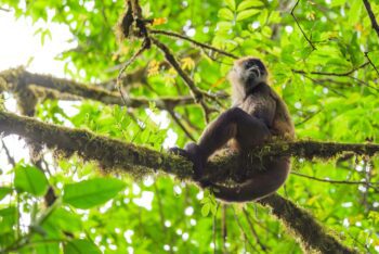
Rincón de la Vieja offers some of Costa Rica’s most accessible volcanic activity. You’ll find bubbling mud pots, hot springs, and hiking trails through diverse ecosystems.
The park sits on the continental divide, creating unique microclimates within short distances.
Road condition reality check: During the dry season, the park access road is manageable with a standard car if you drive carefully. During the green season, that same road can require 4×4 and careful navigation around washouts.
Ready for an Epic Journey? Southern Nicoya Peninsula
Primary Destinations: Santa Teresa, Montezuma, Mal País
- Distance: 150+ kilometers including ferry crossing
- Driving Time: 4-5 hours total travel time
- Vehicle Needed: 4×4 essential
How Does the Ferry Route Work?
This route involves driving south to Puntarenas, taking the car ferry to Paquera, then driving across the southern Nicoya Peninsula to reach the surf towns.
Complete Route Breakdown:
- LIR → Highway 1 South → Puntarenas (2 hours)
- Puntarenas → Paquera ferry (1 hour crossing)
- Paquera → Santa Teresa (1.5-2 hours on rough roads)
The Puntarenas-Paquera ferry runs multiple times daily, but schedules change seasonally. During peak periods, cars can wait 2-3 hours for the next available crossing.
Ferry insider tip: Arrive at the Puntarenas ferry terminal at least 30 minutes before departure. During high season and weekends, buy your ticket in advance online or by WhatsApp on +506 8818 1004 to guarantee space.
What Should You Expect on Peninsula Roads?
Once you reach Paquera, the real adventure begins. The roads to Santa Teresa and Montezuma are notorious for their condition, particularly the final 20 kilometers.
During the dry season, these roads are dusty and rutted but manageable with 4×4. During the green season, some sections become muddy challenges that test both your vehicle and your driving skills.
The landscape makes the rough roads worthwhile. You’ll drive through tropical dry forest, past cattle ranches, and eventually reach some of Costa Rica’s most beautiful and less crowded beaches.
Essential gear for this route: Extra water, snacks, a full tank of gas, and patience. Cell service can be spotty, so download offline maps before departing.

What Do You Really Need to Know About Driving in Guanacaste?
Why Is Navigation Different Here?
Guanacaste uses the same landmark-based directions as the rest of Costa Rica. “300 meters past the school” or “turn left at the big mango tree” are common directions.
Download offline maps before departing LIR. Cell service can be unreliable in rural areas, and GPS satellite coverage occasionally has gaps in mountainous regions.
Local landmarks to know:
- Filadelfia: Major junction town with gas stations and restaurants
- Santa Cruz: Gateway to northern beaches with banking and services
- Sardinal: Access point for northern coast destinations
- Liberia centro: Historic town center with colonial architecture
Where Should You Fill Up?
Gas stations are plentiful along major routes but become sparse on secondary roads to remote beaches. Fill up in Liberia, Santa Cruz, or other major towns before heading to isolated destinations.
Service locations to remember:
- Last reliable gas before Santa Teresa: Nicoya town
- Last gas before remote northern beaches: Santa Cruz
- Emergency services: Liberia Hospital has the region’s best medical facilities
When’s the Best Time to Drive?
Best departure times: Early morning (6-8 AM) offers coolest temperatures and clearest roads. Afternoon rains during the green season can make dirt roads challenging.
Worst times to drive: Late afternoon during the green season when thunderstorms develop. Road visibility drops dramatically during heavy tropical downpours.
Guanacaste’s dry season brings strong winds, especially near the coast. Dust clouds can reduce visibility on unpaved roads, so maintain extra following distance.
Why Does Your Vehicle Choice Matter So Much from LIR?
Unlike other parts of Costa Rica where 4×4 is essential for most destinations, Guanacaste offers more flexibility. But that flexibility has limits.
When Will a Standard Car Do the Job?
The major beach destinations (Tamarindo, Conchal, Playas del Coco) are accessible year-round with standard vehicles. The infrastructure development in northern Guanacaste means paved roads extend closer to beaches than in other coastal regions.
For travelers staying at all-inclusive resorts or focusing on developed beach towns, a fuel-efficient sedan can save money while providing reliable transportation.
When Is 4×4 Non-Negotiable?
Adventure destinations, remote beaches, and any travel during the green season require 4×4 capability. The difference isn’t just comfort—it’s access and safety.
Vamos offers 4×4 vehicles with higher ground clearance and better traction for challenging road conditions. During the green season especially, this can mean the difference between reaching your destination and turning back.
4×4 advantages for Guanacaste:
- Access to remote beaches and surf breaks
- Confidence during afternoon rains
- Ability to explore national park access roads
- Better performance on steep coastal roads

For an in-depth guide including route-specific advice, read our Driving in Costa Rica: What to Expect on the Roads.
How Do You Choose the Right Route for Your Trip?
Your ideal route from LIR depends on balancing your priorities: time, adventure level, and destinations.
Just Want Beach Time?
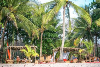
Choose northern beaches (Tamarindo, Conchal, Playas del Coco) for quick access and reliable road conditions. These destinations offer excellent beaches with developed amenities and easy driving.
Craving Adventure and Nature?
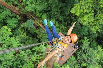
Rincón de la Vieja provides volcano landscapes and adventure activities within an hour of LIR. Combined with northern beaches, it creates an ideal week-long itinerary.
Looking for Authentic, Less-Touristy Spots?
The southern Nicoya Peninsula (Santa Teresa, Montezuma) requires more effort but rewards you with less crowded beaches and a more authentic Costa Rican experience.
Ready to Hit the Road? Here's Your Action Plan
Before you go:
- Check current road conditions for your specific destinations, especially during the green season
- Reserve your vehicle early through Vamos to ensure 4×4 availability if needed
- Download offline maps for your planned routes
- Plan fuel stops in major towns before heading to remote destinations
Upon arrival at LIR:
- Pick up a local SIM card at the airport for navigation and communication
- Get cash in colones for tolls, tips, and small purchases
- Confirm hotel/lodge directions with landmarks rather than GPS coordinates
- Check the weather forecast for your travel days
Your Guanacaste adventure starts the moment you drive out of Liberia Airport. With the right route choice and proper vehicle, you’ll discover why this region has become Costa Rica’s premier beach and adventure destination.
The roads here lead to everything from world-class surf breaks to volcanic hot springs to beaches where you might be the only footprints in the sand. Choose your route based on your interests, respect the local road conditions, and prepare for one of Costa Rica’s most rewarding regions to explore by car.