
Last Updated on November 6, 2025
SJO Road Trip Routes: What's Covered
SJO’s central location puts you 3 hours from Arenal, Manuel Antonio, or Caribbean beaches—offering more flexibility than Liberia (LIR), which commits you to the northern Pacific. Three proven routes connect volcanoes, cloud forests, beaches, and rainforests without excessive backtracking. Standard cars handle most main highways; a 4×4 is required for Monteverde and San Gerardo de Dota mountain approaches.
Quick Facts:
- Classic Triangle (600km, 7-10 days) hits La Fortuna, Monteverde, Manuel Antonio—most popular first-time route
- Dry season (December-April) offers optimal road conditions but higher prices and crowds
- Green season (May-November) brings lush landscapes, 20-30% lower prices, but challenging mountain roads
- Avoid Sunday evening returns to SJO when locals return from beaches—adds 1 hour unless lane reversal is active
- Book 4x4s 2-3 months ahead for peak season—demand exceeds supply during Christmas and Easter
Top 5 SJO Road Trip Routes:
- Volcano-Forest-Beach Triangle – Arenal → Monteverde → Manuel Antonio, 600km in 7-10 days, 4×4 needed for Monteverde approach
- Caribbean Loop – Turrialba → Puerto Viejo → Tortuguero, 700km in 8-12 days, unique Afro-Caribbean culture
- Pacific Coast Explorer – Jacó → Manuel Antonio → Uvita → San Gerardo de Dota, 500km in 8-10 days, maximum beach time
- Quick Beach Escape – SJO → Jacó (1.5-2 hours), fastest route to Pacific using Highway 27, standard car sufficient
- Wildlife & Waterfalls – SJO → La Fortuna → Caribbean coast, combining volcano activities with rainforest exploration
If you need help planning your SJO road trip route and choosing the right vehicle, contact us now!
Landing at Juan Santamaría International Airport puts you right in the heart of Costa Rica’s adventure possibilities. While most travelers think about getting to their first destination, smart road trippers see SJO as the perfect launching pad for exploring multiple regions in a single trip.
The routes from SJO offer the best combination of spectacular scenery, manageable driving, and diverse experiences. Whether you’re planning a week-long adventure or a two-week deep dive, these routes maximize your time while minimizing unnecessary backtracking.
Why Does Starting from SJO Give You More Options?
SJO’s location in Alajuela gives you incredible flexibility. You’re positioned in the Central Valley at about 1,000 meters elevation, which means comfortable temperatures and easy access to mountains, coasts, and everything in between.
Unlike flying into Liberia (LIR) where you’re committed to the northern Pacific region, SJO opens up possibilities in every direction. Within three hours of driving, you can reach active volcanoes, cloud forests, Pacific beaches, or Caribbean shores.
How Far Can You Actually Get from SJO?
Real driving times to major destinations:
- La Fortuna (Arenal): 2.5-3 hours
- Monteverde: 3-3.5 hours
- Manuel Antonio: 2.5-3 hours
- Jacó: 1.5-2 hours
- Puerto Viejo: 4-5 hours
- Tamarindo: 3.5-4 hours

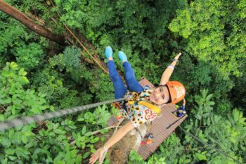
Route 1: Want Volcanoes, Cloud Forests, and Beaches?
This route hits Costa Rica’s three most iconic ecosystems and remains the most popular first-time itinerary for good reason.
The Classic Triangle: SJO → La Fortuna → Monteverde → Manuel Antonio → SJO
Total Distance: ~600km | Recommended Duration: 7-10 days
What’s the Drive to La Fortuna Really Like?
(130km, 3 hours)
The drive to La Fortuna takes you through traditional Costa Rican countryside before arriving at the base of Arenal Volcano. The road is paved and well-maintained, making it perfect for a standard rental car.
Take Highway 1 north to Naranjo, then Highway 142 through Zarcero. You’ll climb through coffee plantations and might catch glimpses of Poás Volcano on clear days. The final approach into La Fortuna reveals Arenal’s perfect cone dominating the skyline.
Worth the detour: Stop in Zarcero to see the topiary gardens at the central park – it’s a 10-minute detour to an authentic mountain town that showcases Costa Rican creativity.
How Challenging Is the La Fortuna to Monteverde Drive?
(114km, 3 hours)
The first half of the journey to the cloud forest of Monteverde begins with a picturesque drive around Lake Arenal on Route 142. When you enter the town of Tilarán, change to Route 145 and drive for about 45 minutes.
Turn left onto Route 606 after Mini Super El Bambu and take your time. The less than 20KM on the windy uphill road to Monteverde takes almost 40 minutes but the views are quite incredible!
Photo opportunity: Consider stopping at the Tilarán Viewing Point (Mirador) for stunning views across the lake and pick up souvenirs from the nearby stands.
What’s the Best Way from Monteverde to Manuel Antonio?
(190km, 4-5 hours)
This drive returns you to sea level for the first hour on Route 606 and takes you from cool cloud forests to tropical Pacific beaches by following Route 1. You’ll descend through multiple climate zones, watching the vegetation change dramatically as you drop elevation.
The route goes through Puntarenas on Route 23 to give you your first glimpse of the Pacific Ocean. From there, it’s a straight shot south along Route 27 then onto the coastal highway, Route 34, to Manuel Antonio.
Driving heads-up: The road from Monteverde to the main highway is challenging – allow extra time and drive slowly on the steep, winding sections.
Local favorite: Pick up a Churchill’s in Puntarenas to cool off with the port’s famous snow cone!
Should You Worry About Traffic Returning to SJO?
(170km, 3½ hours)
The return journey follows Highway 34 then Route 27 back toward San José, climbing gradually from sea level to the Central Valley. This well-maintained highway offers beautiful mountain views as you approach the airport area.
Traffic reality: Avoid this route on Sunday evenings when locals return from weekend beach trips – this can add an hour to your journey unless lane reversal has been applied and then it’s super fast!
Can’t-miss stop: The Tárcoles Bridge lets you see huge crocodiles in the river below. Keep a close eye on your vehicle as petty theft is common at this popular roadside spot.
Route 2: Ready for Caribbean Culture and Rainforests?
For travelers wanting to experience Costa Rica’s unique Caribbean culture, this route offers a completely different perspective on the country.
The Caribbean Loop: SJO → Turrialba → Puerto Viejo → Tortuguero → SJO
Total Distance: ~700km | Recommended Duration: 8-12 days
Why Stop in Turrialba First?
(65km, 1.5 hours)
This route heads around San José and east through Cartago, Costa Rica’s former capital. Use Waze or similar to navigate the roads between the airport to join Route 2 for Cartago to avoid the heaviest traffic.
Leave Cartago on Route 219 and continue past Cot Christ onto Route 130 until Cipreses when you should take Route 10. The drive takes you through some of the country’s richest agricultural areas, with coffee plantations giving way to sugar cane and other tropical crops.
Turrialba serves as your gateway to white-water rafting on the Pacuare River and provides stunning views of Turrialba Volcano on clear days. If you have plenty of time, consider using Cartago as a base to visit Irazú Volcano and the historic buildings in the city.
What Makes the Drive to Puerto Viejo Special?
(163km, 3-4 hours)
The road descends dramatically from the mountains to sea level on Route 10 to join the main highway between San José and Limón, Route 32. After 2 hours driving past banana and pineapple plantations, fields of cattle and family farms thriving on rich volcanic soil, you’ll reach the historic Port City of Limón.
Follow signs for the airport, Puerto Viejo and Sixola to turn right and follow Route 36 through lush jungle with glimpses of the Caribbean Sea until Hone Creek. Instead of turning right to remain on the highway, drive straight ahead onto Route 234 for less than 10 minutes to reach the laid-back beach town of Puerto Viejo.
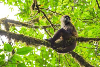
Wildlife spotting: This route offers some of the best roadside wildlife viewing in Costa Rica – keep your camera ready for sloths, toucans, and various monkey species.
What’s Different About the Caribbean Coast?
Puerto Viejo serves as your base for exploring the Caribbean coast’s unique culture. The Afro-Caribbean influence creates a distinctly different atmosphere from the Pacific side, with reggae music, coconut-based cuisine, and a more relaxed pace of life.
From Puerto Viejo, you can easily explore Cahuita National Park, the laid-back beach town of Puerto Viejo, and the pristine beaches of Manzanillo.
Is the Tortuguero Detour Worth It?
For the adventurous, consider returning via Tortuguero National Park. This requires arranging boat transportation from either Moín near the port city of Limón or Pavona near Guápiles, as Tortuguero is accessible only by water or small aircraft.
The experience of traveling through Costa Rica’s canal system provides a unique perspective on the country’s aquatic ecosystems and offers exceptional wildlife viewing opportunities. Either leave your rental vehicle in a secure lot or arrange a pick-up at the dock and fly back to SJO.

Route 3: Looking for Maximum Beach Time?
This route maximizes beach time while showcasing the diversity of Costa Rica’s Pacific coastline.
The Coastal Journey: SJO → Jacó → Manuel Antonio → Uvita → San Gerardo de Dota → SJO
Total Distance: ~500km | Recommended Duration: 8-10 days
What’s the Fastest Way to Hit the Beach?
(SJO to Jacó: 100km, 1.5-2 hours)
The fastest route to the Pacific, this drive takes you through the mountains via Highway 27. The modern highway includes several tunnels and bridges that showcase impressive engineering.
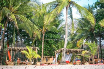
Jacó offers excellent surfing, vibrant nightlife, and serves as a perfect introduction to Costa Rica’s beach culture.
Why Continue South to Manuel Antonio?
(40km, 1 hour from Jacó)
This scenic coastal drive along Route 34 hugs the Pacific shoreline, offering spectacular ocean views and opportunities to spot scarlet macaws in the roadside trees.
Manuel Antonio National Park combines pristine beaches with incredible wildlife viewing – it’s consistently rated as one of the world’s most beautiful national parks.
Should You Push Further to Uvita?
(67km, 1.5 hours from Manuel Antonio)
Continuing south along the coast on Route 34, you’ll discover increasingly pristine and less developed beaches. Uvita offers the famous “whale’s tail” beach formation and serves as a base for whale watching tours.
This section of coast remains more authentic and less touristy than the northern areas.
Why Add Mountains to Your Beach Trip?
(Uvita to San Gerardo de Dota: 114km, 2.5 hours)
This inland detour takes you high into the Talamanca Mountains to one of Costa Rica’s premier cloud forest destinations. Take Route 243 to San Isidro de El General which is a bustling agricultural town and join the Interamericana Route 2 toward San José.
After about an hour, turn left at El Jilguero restaurant and follow Calle San Gerardo to your destination. San Gerardo de Dota offers world-class bird watching, particularly for spotting the elusive quetzal but without the many tourist groups found in Monteverde.
Vehicle alert: The final approach to San Gerardo requires a 4×4 due to steep, unpaved roads.
How Easy Is the Return to SJO?
(70km, 2 hours)
The return journey on Interamericana Route 2 through the mountains offers spectacular views of the Central Valley as you drive into Cartago. Use Waze or another navigational app to guide you from Cartago to San José then onto Alajuela where the airport is located.
Which Vehicle Do You Actually Need for These Routes?
Your choice of rental vehicle significantly impacts which routes you can safely navigate and enjoy.
Where Can Standard Cars Actually Go?
These routes work fine with a regular car:
- SJO to Jacó and Manuel Antonio
- SJO to La Fortuna (dry season only)
- Caribbean route to Puerto Viejo
- Most main highway travel
When Is 4×4 Really Necessary?
You’ll need 4×4 capability for:
- Final approach to Monteverde
- San Gerardo de Dota access roads
- Any route during heavy green season rains
- Beach access roads on the southern Pacific coast
Vamos booking tip: Book your 4×4 at least 2-3 months in advance for dry season travel. Demand far exceeds supply during peak periods, especially for Christmas and Easter weeks.

How Does Season Change These Routes?
What Works During Dry Season (December-April)?
All routes are accessible with appropriate vehicles. This is peak season, so expect higher accommodation prices and more crowds at popular destinations. Road conditions are optimal, and wildlife viewing is excellent as animals congregate around water sources.
What Changes During the Green Season (May-November)?
Roads become more challenging, especially mountain routes. However, landscapes are spectacularly green, and you’ll encounter fewer tourists. Some remote areas may become inaccessible during heavy rains in September and October.
Green season benefits you might not expect:
- Lower accommodation prices
- Lush, vibrant landscapes
- Better rates on vehicle rentals
- More authentic interactions with locals
Which Route Fits Your Travel Style?

What Should You Know Before Hitting the Road?
Where Should You Fill Up?
Fill up whenever you see a station in remote areas. Gas stations can be sparse between destinations, especially on mountain routes.
How Do You Navigate Without Signal?
Download offline maps before departing. Cell service can be spotty in mountainous areas and along remote coastal sections.
When Should You Actually Start Driving?
Start early (7-8 AM) for mountain drives to avoid afternoon rain showers during green season. This also gives you better wildlife viewing opportunities.
What If Something Goes Wrong?
Carry basic tools, a first aid kit, and emergency water. Mountain roads can be challenging, and help might be hours away in remote areas.
Ready to Plan Your SJO Road Trip?
- Choose your route based on interests, time available, and season
- Book appropriate vehicle – reserve 4x4s well in advance for peak season
- Plan accommodation in advance for dry season travel
- Download offline maps and identify fuel stops along your route
- Check current road conditions through local sources before departing
Ready to start planning your Costa Rica road trip from SJO? Our local team can help you choose the perfect vehicle for your selected route and provide current insights on road conditions and must-see stops along the way. With the right preparation and vehicle, these routes showcase the incredible diversity that makes Costa Rica one of the world’s premier road trip destinations.
¡Pura vida and safe travels!